


- EDITIONS:
 Spanish News Today
 Murcia Today
 Alicante Today

PROPERTY SEARCH


Chilly temperatures return: Spain weather forecast May 5-8
A new storm will hit almost all of Spain towards the end of the week

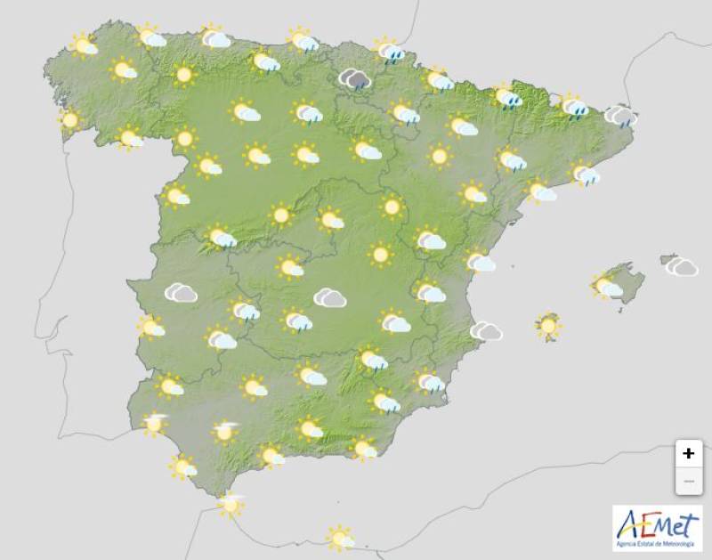
Weather outlook on Thursday afternoon, May 8
The May bank holiday weekend brought torrential rain and hailstorms to many parts of the country and while this new week will start off relatively settled, the umbrellas will need to come back out before too long.
While the week will begin with relatively stable skies, lingering cold air high in the atmosphere and moist sea breezes will combine to trigger scattered showers and possibly strong thunderstorms in some areas. Expect brief but intense downpours, especially in coastal and inland zones.
Monday May 5

From Monday, isolated thunderstorms are likely to pop up across many inland regions. According to the State Meteorological Agency (Aemet), the most affected areas could include parts of the Central System, including regions like Extremadura, Castilla y León, Madrid and northern Catalonia. The unstable conditions are driven by a pocket of cold air and are likely to persist until the weekend.
Several weather alerts have been issued for Monday, including warnings for driving rain and storms in the Valencian Community and dangerous sea conditions in Andalucía caused by strong winds.
Tuesday May 6
A weakening front from the Atlantic will bring rain to the north and northeast of mainland Spain and the Balearic Islands on Tuesday. Some light showers may also reach the centre, east and southeast of the country, though cloudy skies are more likely than heavy rain.
Catalonia and the Valencian Community are also on alert for very strong wind gusts.
Wednesday May 7
Conditions should improve slightly, if only temporarily, midweek. The northern half of Spain will enjoy clearer skies on Wednesday, while the southern half may start off cloudier before brightening later in the day. Any rainfall will be light and scattered, mostly affecting the eastern Mediterranean coast.
In the Canary Islands, cloud cover will increase, particularly over the western islands, where some light to moderate rain is expected in the morning. Again, conditions should improve in the afternoon.
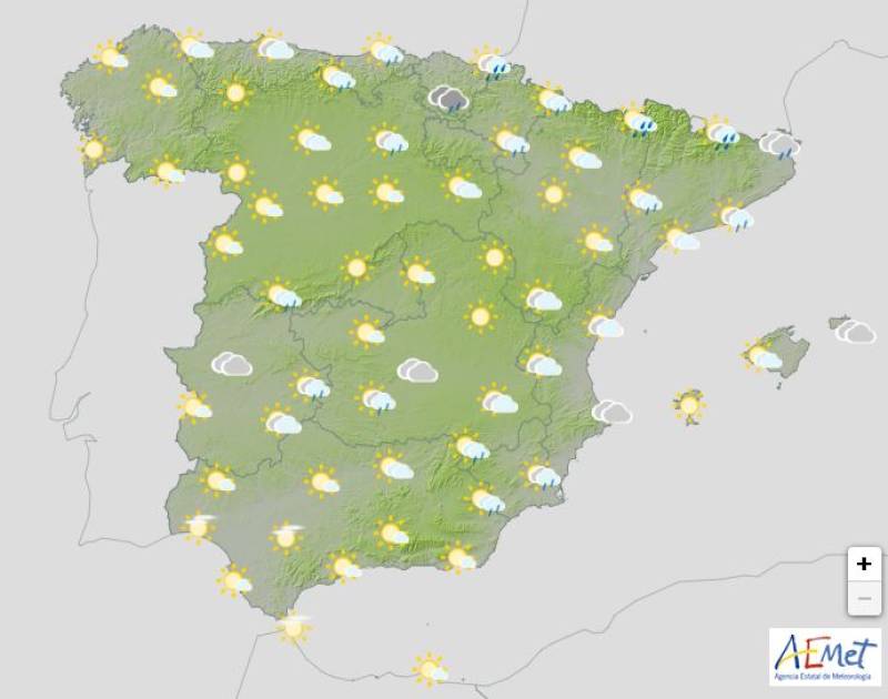
Thursday May 8

A new Atlantic storm system will begin to affect most of the country. After a calm morning, skies will quickly turn overcast as the front moves in from the southwest. Rain will become more widespread and heavier throughout the day, particularly in the north, centre and east of Spain.
The southwest will see some showers too, though they’ll likely be lighter and more scattered.
Temperatures in Spain this week
Cooler air will move into the north of Spain early in the week, gradually easing by Wednesday. But as the Atlantic front pushes in, colder temperatures could return to western regions.
Many areas that recently saw highs of 25–30°C will now see temperatures closer to 20–25°C. In northern plateau cities, daytime highs could even dip below 15°C.
Join our Spain Weather Watch Facebook group for regular updates
Images: Aemet


staff.inc.and
Sign up for the Spanish News Today Editors Roundup Weekly Bulletin and get an email with all the week’s news straight to your inbox
Special offer: Subscribe now for 25% off (36.95 euros for 48 Bulletins)
OR
you can sign up to our FREE weekly roundup!
Read some of our recent bulletins:
Discount Special Offer subscription:
36.95€ for 48 Editor’s Weekly News Roundup bulletins!
Please CLICK THE BUTTON to subscribe.
(List price 3 months 12 Bulletins)
Read more stories from around Spain: