


- EDITIONS:
 Spanish News Today
 Murcia Today
 Alicante Today

PROPERTY SEARCH

Hot and stormy: Spain weather forecast June 23-26
An approaching DANA will bring several rounds of heavy showers and thunderstorms as temperatures soar along the Mediterranean coast
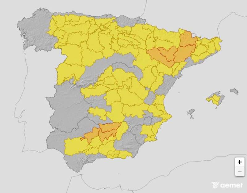
Weather alerts across Spain on Monday June 23
Spain’s game of two halves continues this week with driving storms forecast in the north of the country while the temperatures continue to climb further south.
Between Monday and Wednesday, the weather will be influenced by a DANA off the coast of Portugal, resulting in thunder, lightning and rain in the west of the country and a sharp burst of heat along the Mediterranean coast.
During the second half of the week, a subtropical ridge will once again dominate, causing the mercury to shoot up across the board.
Monday June 23

On Monday June 23, showers and strong thunderstorms are forecast for inland areas of Galicia, Asturias, Cantabria, the Basque Country, La Rioja, northern Castilla y León and lower Aragon. The rain should be fairly light; the danger will come from strong gusts of wind and even hail in parts.
Yellow heat alerts have been activated in the Valencian Community, the Region of Murcia, Madrid and the Balearic Islands, while the temperature warnings have been escalated to orange in Andalucía, Aragon and Catalonia.
Tuesday June 24
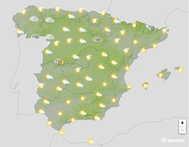
The instability is expected to spread further on Tuesday, although the exact position of the low pressure system is uncertain. At the moment, the State Meteorological Agency (Aemet) forecasts heavy cloud cover, showers and possible thunderstorms in most of the country, although the east of the country should escape any rain.
Daytime temperatures could dip by a degree of two, but the mercury is still expected to hit 34ºC-36ºC in eastern Andalucía, where weather alerts remain active.
Wednesday June 25
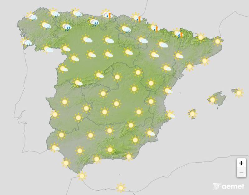
A low pressure zone is expected to continue passing through the northwest of the country on Wednesday, eventually exiting over the Cantabrian Sea. Abundant cloud cover is expected with showers accompanied by thunderstorms in large areas of northern Spain, easing during the afternoon.
A general drop in maximum temperatures is forecast, except along the southeastern coasts and locally in the southwest, where the mercury will continue to hover in the mid to high-30s.
Thursday June 26
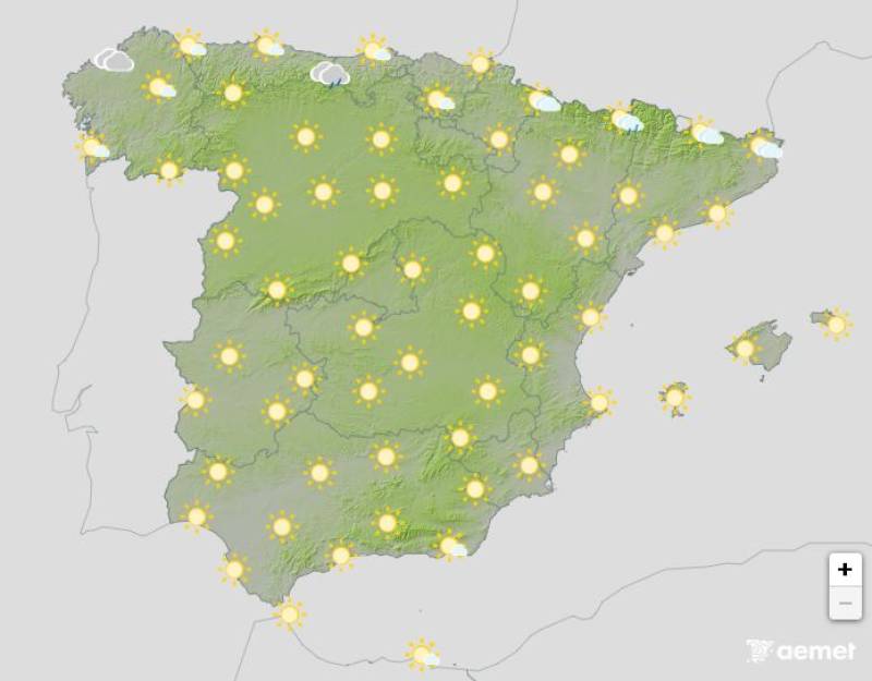
The weather will start to settle down on Thursday, when mostly clear skies are forecast. All of the weather alerts have been lifted, but there’s still a chance of light rain and the occasional thunderstorms in the north.
Daytime temperatures will continue to climb in the south of the country, easily reaching 34ºC-36ºC in most parts.
Join our Spain Weather Watch Facebook group for regular weather and climate change updates
Images: Aemet


staff.inc.and
Sign up for the Spanish News Today Editors Roundup Weekly Bulletin and get an email with all the week’s news straight to your inbox
Special offer: Subscribe now for 25% off (36.95 euros for 48 Bulletins)
OR
you can sign up to our FREE weekly roundup!
Read some of our recent bulletins:
Discount Special Offer subscription:
36.95€ for 48 Editor’s Weekly News Roundup bulletins!
Please CLICK THE BUTTON to subscribe.
(List price 3 months 12 Bulletins)
Read more stories from around Spain: