


- EDITIONS:
 Spanish News Today
 Murcia Today
 Alicante Today

PROPERTY SEARCH


Iberian oven cranks up the heat: Spain weekend weather forecast May 29-June 1
Orange and yellow weather warnings for extreme heat have been activated across Spain for the next few days
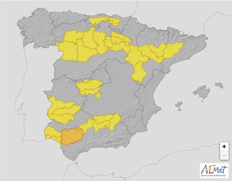
Weather alerts on Friday May 30
Summer has arrived with a real bang, with temperatures literally shooting up overnight to trigger what meteorologists call the ‘Iberian Oven’ effect. The State Meteorological Agency (Aemet) has warned that the country is currently experiencing an “extraordinary episode of maximum temperatures,” with daytime highs expected to approach 40ºC in some areas and night-time lows struggling to drop below 20ºC.
We are now entering the peak of this intense heatwave. While the overall weather will remain settled for the most part, a front approaching from the Atlantic is likely to bring instability and lead to thunderstorms over the weekend.
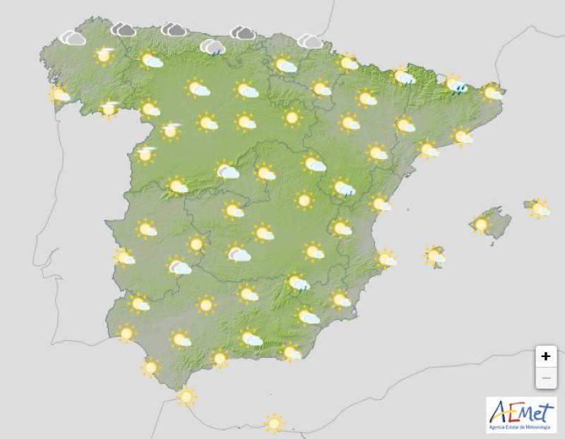
On Thursday May 29, temperatures will continue to climb in many areas, particularly in the south, where they are forecast to range between 34 and 40ºC. Aemet has issued an orange alert for dangerously high temperatures in Andalucía. Yellow weather warnings are also in place for several other regions, including Catalonia and Galicia.
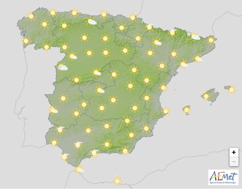
Weather outlook on Thursday May 29
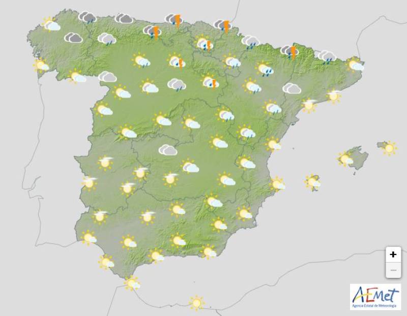
Beginning on Friday May 30, conditions are expected to shift as the Atlantic trough begins to influence the atmosphere. Combined with the heat at the surface, this instability will likely trigger showers and thunderstorms across much of the country.
During the afternoon, cloud cover is forecast to increase over much of inland Spain. Rain and storms may develop in inland Galicia, the Cantabrian Mountains, the Iberian Range and parts of the central and southeastern mountain systems.
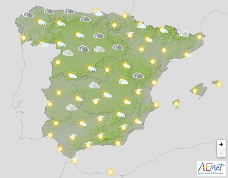
Weather outlook on Friday May 30
Yellow warnings have been issued for severe storms that could include strong gusts of wind across the northern plateau, the Iberian system, the Tagus Valley, Montes de Toledo and southern Badajoz. There is also the chance of hail in inland areas of Cantabria and Bizkaia, and the risk of strong winds remains throughout these regions.
The approaching Atlantic front will continue to affect weather conditions through the weekend. On Saturday May 31, the day will start off sunny and calm but in the afternoon, clouds are expected to build over large parts of Spain’s interior.
Weather outlook on Saturday May 31
Scattered showers and thunderstorms, generally light in nature, are forecast for the Cantabrian Mountains, the Pyrenees, inland Catalonia, the Valencian Community, Murcia and the eastern mountain ranges of Andalucía.
On Sunday June 1, which marks the beginning of meteorological summer, cloud cover is expected to be more widespread. Showers and thunderstorms are likely to form again in the afternoon, particularly in the northern third of the country.
Weather outlook on Sunday June 1
The regions most likely to be affected include Galicia, Asturias, Cantabria, the Basque Country, Navarra, La Rioja, Castilla y León, Aragon and inland parts of Catalonia and the Valencian Community. Storms could be more intense in mountainous areas.
Join our Spain Weather Watch Facebook group for all the latest weather and climate change updates
Images: Aemet


staff.inc.and
Sign up for the Spanish News Today Editors Roundup Weekly Bulletin and get an email with all the week’s news straight to your inbox
Special offer: Subscribe now for 25% off (36.95 euros for 48 Bulletins)
OR
you can sign up to our FREE weekly roundup!
Read some of our recent bulletins:
Discount Special Offer subscription:
36.95€ for 48 Editor’s Weekly News Roundup bulletins!
Please CLICK THE BUTTON to subscribe.
(List price 3 months 12 Bulletins)
Read more stories from around Spain: