


- EDITIONS:
 Spanish News Today
 Murcia Today
 Alicante Today

PROPERTY SEARCH


Orange alerts for freezing temps and snow: Spain weather forecast Nov 20-23
The weekend ahead will be cold, wet and overcast in most of Spain with a little warm relief on Saturday
Widespread weather warnings have been issued for Friday November 21
Storm Claudia may have passed, but it’s been replaced by an Arctic air mass that’s been slowly moving over Spain for the last few days. As it’s name suggests, this front will result in sub-zero temperatures in large parts of the country and some of the first snow of the season.
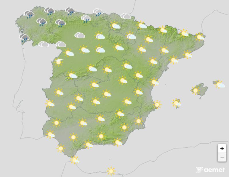
Thursday November 20
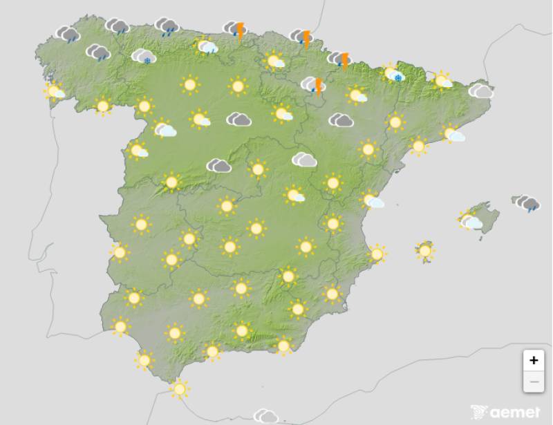
The Arctic mass will result in overcast skies and heavy downpours in northern and central areas on Thursday, where wild thunderstorms and hail are also expected. Cloudy skies will also prevail in the rest of the country and there’s a good chance of showers, although it should be a bit brighter in the southwest.
The snow level will drop from around 1000 metres to 500 metres, with significant accumulations in the mountains of the northern third of the country, especially in the Cantabrian Mountains, the northern Iberian System and the Pyrenees.
Daytime temperatures will drop across the board, although highs of 20ºC should still be reached in the likes of Alicante and Malaga.
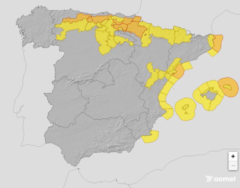
Orange alerts for snow and strong winds have been activated by the State Meteorological Agency (Aemet) in Asturias, Cantabria, Castilla y Leon and Catalonia.
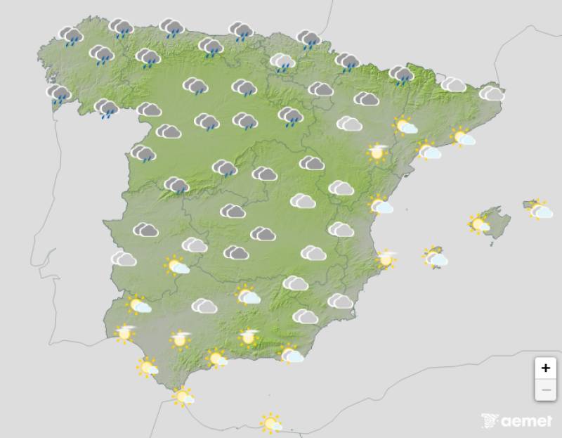
Friday November 21
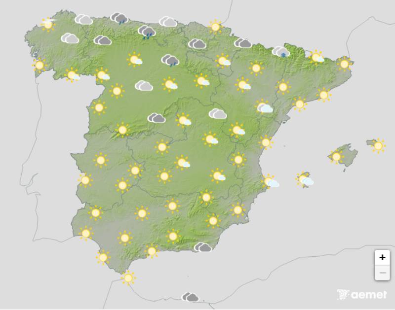
Widespread weather warnings are in place on Friday as temperatures continue to plummet, dropping to zero on Friday night in Madrid and well below it in other parts of central Spain. Persistent, heavy rainfall will again dampen northern Spain, where it will remain overcast, but plenty of bright, sunny spells are expected further south.
Orange alerts for snow and/or strong winds and rain: Asturias, Cantabria, Catalonia, Navarra, the Basque Country, the Balearic Islands.
Yellow alerts for low temperatures and/or strong winds: Aragon, Castilla y Leon, Region of Murcia, La Rioja, the Valencian Community.
Saturday November 22
A new front will replace the cold Arctic air mass with a warmer one, but it will still be cloudy or overcast in most of Spain. Rain is expected in the northern half of the country and the Balearic Islands, with the possibility of occasional thunderstorms on the islands. Light rain is also possible in mountainous areas of the southeast, the northern Mediterranean coast and the western Alboran Sea.
Daytime temperatures will rise ever so slightly along the Atlantic coast.
Orange alerts for strong winds and/or freezing temperatures: The Balearic Islands and Catalonia.
Yellow alerts for strong winds and/or freezing temperatures: Aragon and the Valencian Community.
Sunday November 23
Intense Atlantic circulation and the arrival of high pressure in the southwest of the Iberian Peninsula will again lead to dark skies, thunderstorms and heavy rain in much of the north. Thanks to the slight warming on Saturday, the snow level should climb to between 700 and 2,000 metres.
Temperatures will rise across the country, but Sunday night will be noticeably cooler in the Guadalquivir Valley and along the Mediterranean coast.
Join our Spain Weather Watch Facebook group for all the latest weather and climate change news
Images: Aemet


staff.inc.and
Sign up for the Spanish News Today Editors Roundup Weekly Bulletin and get an email with all the week’s news straight to your inbox
Special offer: Subscribe now for 25% off (36.95 euros for 48 Bulletins)
OR
you can sign up to our FREE weekly roundup!
Read some of our recent bulletins:
Discount Special Offer subscription:
36.95€ for 48 Editor’s Weekly News Roundup bulletins!
Please CLICK THE BUTTON to subscribe.
(List price 3 months 12 Bulletins)
Read more stories from around Spain: