
- EDITIONS:
 Spanish News Today
 Murcia Today
 Alicante Today
Walking routes Cieza, the PR-MU 25
Almadenes – Almorchón, 13.3 kilometres
Click here for Wikilocs
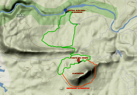
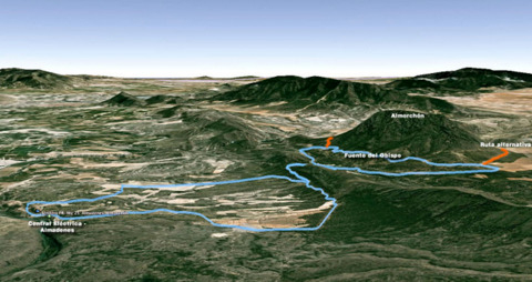
The PR-MU 25, Almadenes - Almorchón, is a medium length popular walking route in Cieza and is a well sign posted, circular route through one of the most characteristically Ciezan areas of the municipality.The walk crosses through fields of peaches and includes the final section of the Cañón de Almadenes (Almadenes gorge) and the mole de Almorchon (Almorchon mountain), an area of pre-historical significance and settlement.
The walk starts by the asphalted access road to the Almadenes Power Station which is well sign posted by a milestone marking the start of the walk.
After about 400 m, opposite the Power Station´s reservoir, the route takes a gently downward sloping forest path which is on the left hand side and goes towards the Losares area.
Losares has a wealth of caves, shelters and holes in the ground which have been caused by the natural erosion of the stone by the water. Some of these caves have been used by humankind since prehistory and have fine examples of prehistoric cave paintings, some of which are accessible on foot, others not.
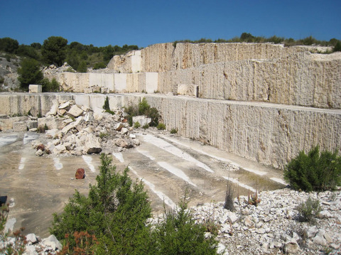
This is an area of great geological value and also includes important deposits of marble. Further along the route an abandoned marble quarry is still visible along the pathway.
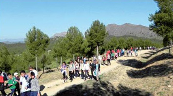
The forest path takes the north slope of the Sierra de la Palera. There is abundance of lush vegetation during this section of the walk and the spectacular views of the Vega de Cieza (the meadowlands of Cieza), dotted with numerous expanses of fruit trees, glimpsed between the tree tops. Under the shady canopy of the Palera the walk leaves behind a route on the left that will be used at the end of the walk to return back to the starting point. To stick to the itinerary, follow vertical signage which can be found throughout the route.
The route briefly abandons the forest path and turns right for a few metres on the asphalted road to the Pantano de Alfonso XIII (Alfonso XIII reservoir), it then turns again to the left taking the forest track that leads to the foot of Almorchon. Although the proposed route follows the north slope of this mountain, it is also possible to take the southern slope of the Almorchón taking mainly the GR-7 path.
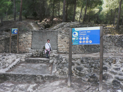
Both paths, the northern and southern, lead eventually to the recreation area at Fuente del Obispo, an ideal location to take a break and to rest on the tables and benches that are provided. The route then descends via the service road to the Cárcava reservoir. The asphalt path leads gently up to the reservoir and after 1 km reaches the crossroads that again leads the walker along the north face of Sierra de la Palera towards the Losares area taking the same route of the start of the walk. The route then goes right at the crossing taking the forest track through almond plantations and which ends at the asphalt road that goes to the Almadenes´ Power Station. The route takes the left road and continues the final kilometers on the asphalt until reaching the starting point.
Points of interest:
Cañón de Almadenes
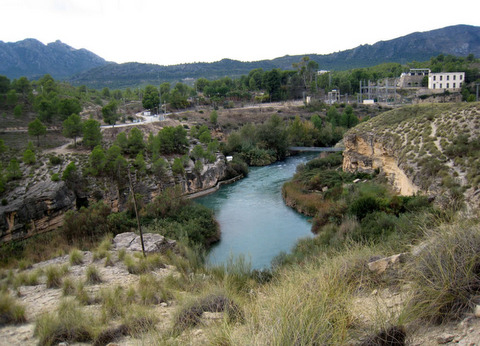
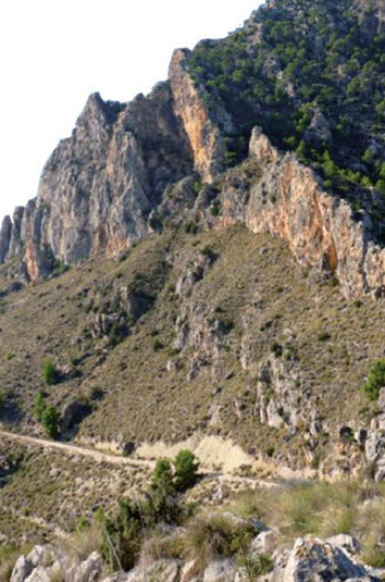
This natural gorge, carved by the Segura river for millions of years can be seen at the beginning and end points of the route. The river has created on of the most beautiful spots in the region of Murcia by carving a 4 km gorge with vertical walls with some sections reaching 100 metres in height. Nearby is the Fuente del Gorgotón o Borbotón (Source of Gorgotón) a water source that has sprung up in the middle of the Segura river creating a unique natural swimming pool for this community.
Fuente del Obispo
This is a recreation area in the shady mountain of Almorchón which has tables and benches as well as wooden decorative carvings. It is an ideal open air location for resting and re-gaining your strength.
Details about the route:
Access to the route: Carretera a Mula, Heading for the Embalse de Alfonso XIII
Start and finish point: camino de acceso a la Central de Almadenes. (Access path to Almadenes´Power Station
Click for Google map, which shows start and finish point, Cañon de Almadenes, Cieza
Coordinates: East 626344, North 4233132
Total Distance: 13.31 Km. Estimated time: 3 hours.
Asphalted or cement part of the route: 3 Km.
Forest part of the route: 10 Km.
Minimum Altitude: 199 m. Maximum Altitude: 398 m.
Accumulated climb: rising 297 m. descending 291 m.
Level of difficulty: Medium
Tourist Office Cieza
Assistance can be provided by the Tourist office in Cieza who can provide leaflets, information about local restaurants or hotels in the area. Click to contact Cieza Tourist office.
This route is attractive during La Floración, when the whole area is smothered in peach blossom as the 5,000 hectares of peach orchards which surround the town flower from early March to mid April each year.


